
Remote Sensing
In stock
$5.00
item details (5 Editable Slides)
- Applications Supported: PowerPoint, Google Slides
- File Type: .pptx, Google Slides
- Aspect Ratio:16:9 (Wide Screen)
- Animation: Yes
Remote Sensing
Remote Sensing
(5 Editable Slides)
Related Products

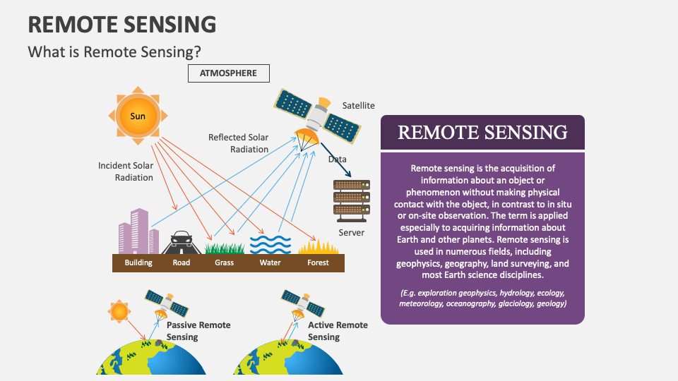
Capitalize on our Remote Sensing presentation template for MS PowerPoint and Google Slides to describe the technique used to gather information about the objects or phenomena related to the earth or other planets via remote sensors. This deck is an excellent pick to demonstrate the significance and real-world applications of this technology in a well-organized manner.
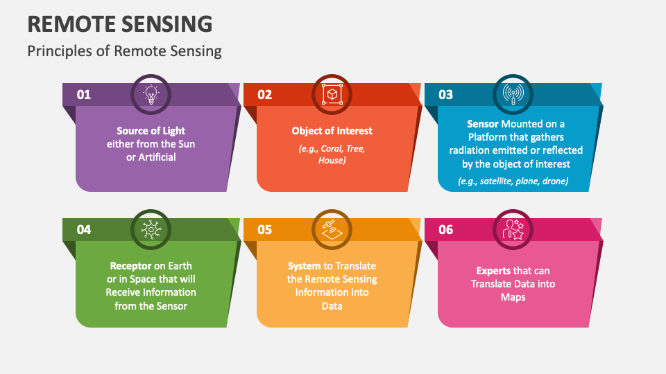
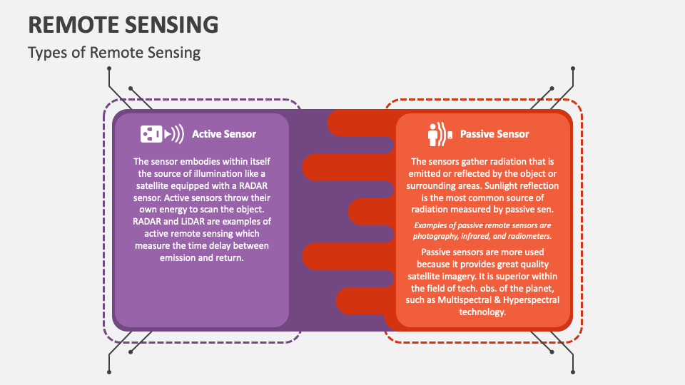
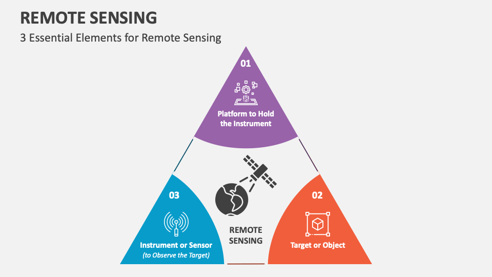
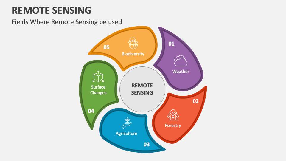
Engineers can educate their audience on the types, essential elements, and principles of remote sensing. Utilizing our fantastic PPT, you can illustrate the sectors or domains in which this technology is used, including weather, forestry, biodiversity, and more. Researchers can highlight the significance of remote sensing in providing valuable insights into environmental changes, resource availability, and land use patterns.