
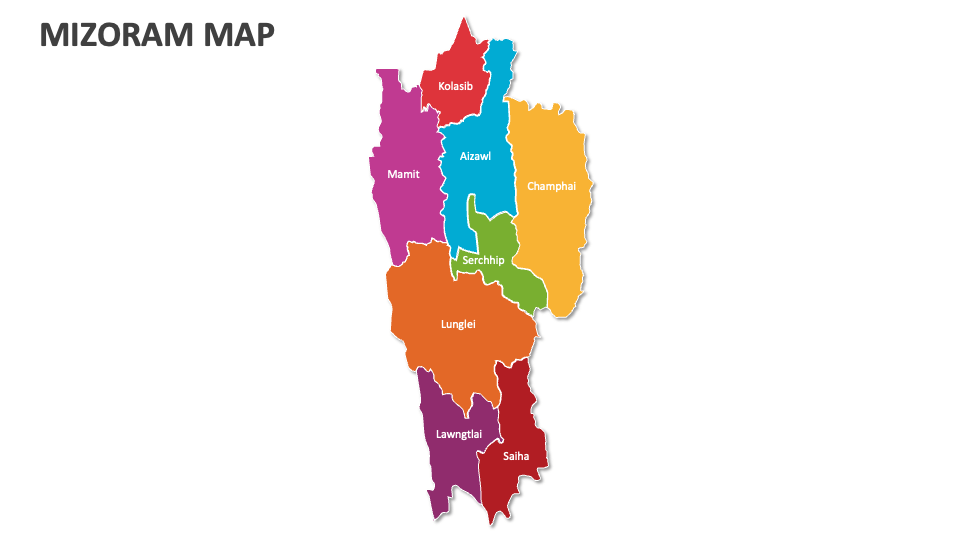
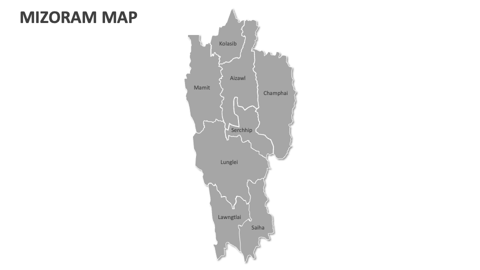
Mizoram Map
In stock
$5.00
item details (2 Editable Slides)
- Applications Supported: PowerPoint, Google Slides
- File Type: .pptx, Google Slides
- Aspect Ratio:16:9 (Wide Screen)
- Animation: No
Mizoram Map
Mizoram Map
(2 Editable Slides)
Related Products
Grab our Mizoram Map presentation template for MS PowerPoint and Google Slides to showcase information about climate conditions, telecommunication network coverage areas, innovation hubs, key agricultural hubs, etc, in Mizoram. You can also use these map illustrations to highlight the geographical location of this state in India.
Textile manufacturers can present the regions in Mizoram known for specific crafts/textiles, like Puan and Ngotekherh from the Serchhip and Aizawl districts. Government officials can illustrate information about the electoral constituencies, voting patterns, and administrative districts in this Indian state. Healthcare professionals can visualize information about the distribution of healthcare infrastructure across this state, the prevalence of various diseases, and areas with the highest healthcare needs.